Offa’s Dyke Path

In 2014 I walked the 285km Offa’s Dyke Path from Chepstow to Prestatyn along the Wales-England border, staying at pubs and B&Bs along the way.
The intermittent structure is a large linear earthwork that roughly follows the border. It’s named after Offa, the Anglo-Saxon king of Mercia from 757 to 796, who is traditionally believed to have ordered its construction.
Although its precise original purpose is debated, it delineated the border between Anglian Mercia and the Welsh kingdom of Powys.
Here are the notes I wrote at the time and some photos:
21 March 2014
I leave Adelaide tonight on the trip of a lifetime, spending three weeks in England, Wales and Ireland.
I’ve wanted for many years to walk the 280km Offa’s Dyke trail from Chepstow to Prestatyn along the England-Wales border, and will commence that journey on Monday, March 24.
On April 5, I will take a ferry to Dublin and spend three nights there before heading to Kilkenny for three nights.
There’s an element of pilgrimage in that I’ll be visiting two of the villages where four of my great-great grandparents came from — Whitchurch in Herefordshire and Thomastown in Ireland.
The first leg of the journey sees me leave Adelaide at 10.30 tonight, arriving at Gatwick on Saturday afternoon.

23 March 2014
I toured Chepstow Castle this morning and was enthralled by the experience. Construction began in 1067, just one year after the Norman invasion.
The castle was extended many times over the years until the garrison was disbanded in 1685.
Major battles were fought here during the Civil War between Royalist and Parliamentary forces, when cannon fire damaged the walls.
Chepstow’s strategic position enabled defenders to supply the castle via the river during times of battle and siege, while defending it against attack.
King Edward I visited here with Queen Eleanor and presumably feasted in the Great Hall.
Its 800-year-old doors are said to be the oldest in Europe. The castle is also the oldest surviving post-Roman stone fortification in Britain.
Chepstow Castle is a hauntingly beautiful historical site and well worth a visit. It’s open to the public, and since 1984 has been in the care of Cadw, the Welsh government organisation with the responsibility for protecting, conserving and promoting the built heritage of Wales.
In the afternoon I caught a local bus from Chepstow to nearby Tintern to see the historic Tintern Abbey.
My walk tomorrow will take me on a ridge overlooking the village, but I won’t have time to descend and see this amazing place.
Tintern Abbey was founded by Walter de Clare, Lord of Chepstow, on 9 May 1131. In the reign of Henry VIII, his Dissolution of the monasteries ended monastic life in England and Wales.
On 3 September 1536 Abbot Wyche surrendered Tintern Abbey and all its estates to the King’s visitors and ended a way of life which had lasted 400 years.
The building is incredibly haunting in its grandeur, rich in stories and memories. It’s still hard to conceive that Henry’s determination to gain a divorce caused such upheaval and had so many consequences.
I had lunch at the Anchor Inn, presumably so named because it adjoins the River Wye.

24 March 2014
I walked past Devil’s Pulpit on the Offa’s Dyke trail, where according to legend, Old Nick used to preach temptation to the monks of Tintern Abbey.
I arrived in Monmouth about 3.15pm after a challenging 27km walk from Chepstow. There was lots of mud.
Monmouth Castle was first built to defend Norman England against the Welsh in the late 11th century.
Only ruins of the Great Hall remain, dating back to about 1270. It’s believed Henry V was born here in 1387.
The castle now adjoins the parade ground of the Royal Monmouthshire Regiment, the origins of which date back to the 1530s. The Regiment remained loyal to the crown during the Civil War.
Monmouth Castle changed hands three times during the war, finally falling to Parliamentary forces after a brief siege in 1645.

Whitchurch, Herefordshire
I took a detour from Offa’s Dyke Path to visit Whitchurch in Herefordshire, where two of my great-great grandparents, James Evans and Sarah Hardwick, were married in 1849, departing immediately afterwards for Australia.
The village is probably no bigger today than it was then, but is now divided by a motorway.
I’m staying in a building, Norton House, that dates back to the 17th century.
It’s hard to know what James and Sarah would recognise if they returned to day, but certainly the historic church of St Dubricious would be familiar.
Its foundations date from the 9th century and the oldest part goes back to the 13th century.
The church is in the Decorated style of architecture with walls of local sandstone rubble and ashlar and the roof of stone slates.
The bowl of the font, where Sarah was probably baptised, is Norman in origin, the lower edge being cut away to octagonal form to fit a 14th or 15th century stem with a square base. The church was enlarged in Victorian times.
St Dubricius lived in Herefordshire in the 6th century and founded monasteries which were centres of learning.
Legend has it he had a miraculous birth. A tulip tree near the south porch is reputed to be over 300 years old and blooms every year in June and July. The River Wye flows nearby and sometimes floods.
There are ancient forests in the area and interesting archaeological sites including a Roman fort.

White Castle
White Castle (Welsh: Castell Gwyn), also known historically as Llantilio Castle, is a ruined castle near the village of Llantilio Crossenny in Monmouthshire, Wales.
The fortification was established by the Normans in the wake of the invasion of England in 1066, to protect the route from Wales to Hereford.
Hay-on-Wye
Today’s walk took me from Pandy to Hay-on-Wye via the Black Mountains. Pandy was a disappointing stopover. It’s a strategic point on the trail, but it’s just a commuter village on a main highway. There was nothing much to see.
However, leaving the village this morning soon brought some fascinating views, despite the mist.
I passed an Iron Age fort and a stone wall enclosure, where the first traces of snow began to show.
Navigation was difficult because of sheep tracks heading everywhere, the mist and a lack of marking.
But I soon found my bearings and ascended to a high ridge, where the snow was fresh and thick. The wind chill made it very cold, and I rugged up with gloves, jacket and a beanie.
The trail was much firmer than the previous two days and extensive work has been undertaken to reduce erosion.
The fog meant I didn’t get to see the promised views of England and Wales, but I enjoyed walking in the snow and jogged in places to keep warm.
That meant I made good time to Hay-on-Wye, which I was keen to do, so I could explore the town which is famous for its book stores.

Hay-on-Wye (Welsh: Y Gelli Gandryll), is a small market town of 2000 people in Powys, Wales, situated on the English border.
Often described as “the town of books”, it is the National Book Town of Wales. The town lies on the east bank of the River Wye and is within the Brecon Beacons National Park, just north of the Black Mountains, where I was hiking yesterday.
I’m staying at a lovely B&B called The Start on the north bank of the River Wye.
Hay-on-Wye is a popular destination for bibliophiles, with two dozen bookshops, many selling specialist and secondhand books.
I saw one shop selling only poetry books and another selling crime and mystery. Apparently the number has declined sharply in recent years, many becoming general antique shops, or selling art and craft.
I was actually a little disappointed because I expected more book shops. The town was quiet, being midweek in early spring, but I imagine it fills up on weekends.
I was pleasantly surprised and impressed to find a tapas bar last night, where I had a tasty dinner. It was nice to eat something other than stodgy pub food.
28 March 2014
Today’s walk on the Offa’s Dyke trail took me to Newchurch and Gladestry on the way to Kington.
29 March 2014
The sun is shining today and after an absence of 87km, the trail has rejoined the dyke. I have arrived in Knighton, the ‘town on the dyke’, almost half way along the trail.
It was a lovely day, mild and mostly sunny, with just a light breeze in the early stages. That meant I was able to appreciate some spectacular views, which previously have been hidden from me in mist, rain and snow.
Offa’s Dyke half way
Today I passed the halfway point on the Offa’s Dyke Path. Only 144km to go! It was described in the guide book as the hardest day of the walk, with lots of steep climbs.
I had good weather though and blitzed it, arriving at my B&B just after 2pm. My hosts said that was the earliest anyone had ever arrived.

Powis Castle
This morning’s walk along the Offa’s Dyke trail was mostly through fields and I saw very little of the dyke. The terrain was flat, but the grass was heavy with dew and my shoes became saturated. I’m using my trekking shoes now, which are low cut like runners.
The waterproof hiking boots were too hard on my ankles. I’m wearing waterproof socks with the shoes, and they’re proving to be worth every cent of the $40 I paid for them.
I wash them by hand at the end of each day, making my eight other pairs of socks redundant.
I had no qualms about leaving the trail just after half way today at a village called Kingswood, especially as the terrain along Offa’s Dyke was not that interesting (I’m getting spoilt now).
It meant walking for 6km along a busy road, which was the only downside. The alternative route took me to Powis Castle, one of the most significant National Trust estates in Britain. It meant walking along a busy road for 6km, but it was worth it.

Powis Castle dates back to the 13th century and remains in private hands today. It is open to the public as one of Britain’s most significant National Trust estates.
It is one of the few border castles that predominantly served Welsh interests, rather than English, in medieval times.
It was a short walk from there to nearby Welshpool, population 6200, close to where I’m staying tonight in a B&B on a farm.
According to Wikipedia, Welshpool served briefly as the capital of Powys after its prince was forced to flee the traditional Welsh royal site at Mathrafal in 1212.
The Long Mountain provides a backdrop to most of Welshpool, which once served as the ultimate grounds for defence for fortresses in the times when the town was just a swampy marsh.
The town is 6km from the border and was strategically important when the Welsh and English were at loggerheads. Apparently its sheep market is the largest in Europe.
The main street has a variety of shops, similar to a town of the same size in Australia, but older in construction.
As with most villages and towns that I’ve seen, the dominant landmarks are churches and a clocktower.
I again set a record time for early arrival at my accommodation. It seems to unsettle them a little because it’s unexpected, but I don’t think 2.30pm is too early.
I will give some feedback to the travel company when I’m done, but I would prefer to stay in towns or villages, rather than on farms. My opportunity to explore and interact socially is somewhat restricted, but I will walk into Welshpool for dinner tonight.
The exception is Friday and Saturday nights, when perversely they had me staying at a noisy pub.

1 April 2014
Tynllwyn Farm is typical of the B&Bs that I’ve been staying in along the Offa’s Dyke trail. It’s a large house in which the family resides in part. In this case, the upstairs rooms have been converted to ensuite bedrooms. The view from my window this morning is of mist over the valley. Beautiful.
It’s also promising for early sunshine on the long walk. Day eight of the Offa’s Dyke walk and I was heading along the Montgomery Canal.
Britain has an extensive network of navigable canals, which were important transport routes in past centuries.
This one dates back to the 1790s and is unusual in that it was developed to ship lime into the Severn Valley to boost agricultural production, rather than for general commerce or to move goods out.
The canal fell into disrepair and disuse, but is gradually being restored. I enjoyed walking along here in fine weather.
Day eight was 16.3 miles from Buttington to Trefonen via Llanymynech. I had the option of walking along the River Severn or the Montgomery Canal and I chose the canal.
The only thing I haven’t enjoyed about the trip so far is walking through muddy fields and I guessed correctly the river route would have plenty of those.
Instead, the canal had a ‘tow path’ running its full course, sealed or gravel in places, which made for pleasant walking.
Today was also the best weather of the trip so far, with warm sunshine from the outset and little mist. I saw swans, frogs and pheasants along the canal and more squirrels in the woods.
I missed a turn in Llanymynech and followed the Shropshire Way walk by error for half a mile, thereby adding a mile to my designated 16.3. After leaving the canal I climbed past a quarry and through a golf course before encountering more muddy fields and ascending Moelydd, which at 934 feet offered panoramic views.
It was a short walk from there to Trefonen where I am staying tonight and where I will dine at The Barley Mow and sample some locally brewed Offa’s beer.
The Barley Mow pub in Trefonen is attached to the Offa’s Dyke Brewery, which produces four interesting beers. I’m not a big fan of British beer, but the dark ale here had good flavor.
The meal was good value, just 10 pounds for two courses, both good-sized helpings. I had gammon steak for the first time. Had to Google it, it’s ham cured slightly differently.

2 April 2014
Pontcysyllte Aqueduct was built from 1795 to 1805 as part of the Ellesmere Canal. It’s a navigable aqueduct that carries the Llangollen Canal over the valley of the River Dee.

At 307 metres long and 38 metres high, it is the longest and highest aqueduct in Britain and a World Heritage site.
Wikipedia tells me that a feature of a canal aqueduct, in contrast with a road or railway viaduct, is that the vertical loading stresses are virtually constant.
According to Archimedes’ principle, the mass of a boat and its cargo on the bridge pushes an equal mass of water off the bridge.
Today I passed where the Battle of Crogen took place in 1165. An alliance of Welsh princes led by Owain Gwynedd defeated the larger English army of Henry II.
Henry’s army had the advantage of greater numbers, so Owain’s tactics were to raid and ambush. He planted skirmishers in the thick woods overlooking the pass Henry would take.
When Henry’s army advanced into the densely wooded Ceiriog Valley, the Welsh defenders assailed them repeatedly from their positions of cover.
Realising the vulnerability of his army, Henry ordered 2000 woodsmen to clear trees and widen the passage, allowing his forces to move more freely and quickly through the pass.
The woodsmen were protected by the best of Henry’s army and a powerful vanguard of pikemen, but their resistance was only effective for a short period.
The Welsh victory pushed Henry back to England and preserved the principality’s independence until Edward I succeeded where Henry had failed more than a century later.
I am walking along a 1300-year-old earthen rampart and seeing evidence every day of significant historical events. It’s exhilarating and humbling.

Llangollen
I have arrived at Llangollen in Denbighshire, north-east Wales. The town of 3400 people is on the River Dee and on the edge of the Berwyn mountains.
Llangollen takes its name from the Welsh term for “a religious settlement” and Saint Collen, a 6th-century monk who founded a church beside the river.
Situated above the town is Castell Dinas Brân, a stronghold of the Princes of Powys, which I will visit tomorrow. The forecast was for rain this afternoon, so I left earlier than usual at 8am, and bypassed Chirk Castle.
I also took the canal route from the aqueduct instead of traversing muddy fields and forests.
Sadly, there are just two days to go.

3 April 2014
Just out of Llangollen, I’m shrouded in mist at the haunting ruins of Castell Dinas Bran.
Built in the 1260s, it was a stronghold of Welsh princes before the English invasion by Edward I in 1276, after which it was abandoned.
I stopped for lunch in a small village called Llandegla, named after its patron saint, St Tecla (also St Tegla).
There is a large forest of fir trees nearby, which I was supposed to walk through, but due to fallen trees I had to make a long detour and walk around it.
This added an hour to my walk. I made up most of the time by running for a mile or so into the village.
Llandegla was historically located on one of the main drovers’ roads from the north-west coast of Wales to the markets of England, and the cattle trade was central to its economy.
When droving diminished, the main industry was quarrying.
St Tecla’s Well
There is a curious tradition associated with St Tecla’s Well, a spring in a field close to the church.
Sufferers of what was known as Clwyf Tecla (epilepsy), “St Tecla’s disease”, washed themselves in the well after sunset and walked round it three times, leaving an offering of fourpence.
They then went into the church, carrying a chicken while reciting the Lord’s Prayer.
They were meant to sleep overnight under the communion table, and if the chicken died, it was a sign they were cured. Presumably this was a pagan ritual adopted by early Christians.
For the record, I washed my hands in the well, but didn’t leave an offering or take a chicken into the church. I did pay one pound for a chocolate bar in the church.
It’s a fine practice that rural churches provide tea, coffee and sweets on an honor system for walkers and visitors.

4 April 2014
Today I am walking past and around ancient hill forts. Iron Age Britons lived within these forts for mutual defence from hostile neighboring tribes.
Moel Arthur is a good example with a circular ring beneath the summit.
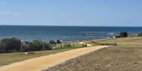
I ambled into Prestatyn after walking about 35km to complete the 285km Offa’s Dyke Path from Chepstow.
It’s a grand sense of achievement to know I have walked the length of Wales from south to north, largely following a 1300-year-old earthen rampart.
Today was the longest walk of the trip. Because of a mix-up by the travel agent, who confused the finish date, I was scheduled to end seven miles short of Prestatyn today and get a taxi for the last part, but I was feeling good and decided to walk the extra distance.
There wasn’t much more to observe, just some views of wind farms in the sea, but it closed the loop.
Today’s highlight was the Iron Age hill forts and the high moors. I love feeling so isolated while knowing how close I am to cities. Liverpool, for example, was only 70km away.
I lost the path for a while and followed local roads to get back on track. That was all part of the adventure.
A special mention to my feet. They served me well, with barely a complaint!